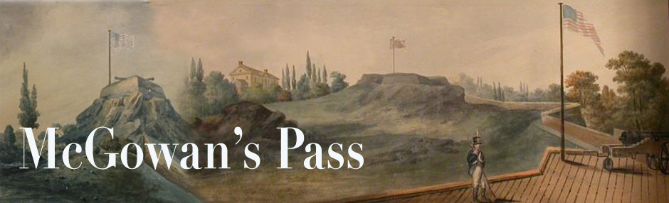

A drawing c. 1855 from Valentine’s Manual, supposedly an 1814 view of Fort Fish and Nutter’s Battery (Nutting Battery?). There is also Fort Clinton, the teepee-like rock in the left distance. And finally the McGowan house at the top of McGowan’s Hill, right across the road from Fort Fish.
We looking from the north, along the Kingsbridge or Post Road, over a little bridge crossing the Harlem Creek. It is this little pathway, now in the Harlem Meer, that is often wrongly cited as “McGown’s Pass.”
This view is hard to reconcile with present geography, or the more authoritative renderings of the 1814 period (particularly one of John Joseph Holland’s, shown below). The two-windowed building on the left is probably supposed to be the gatehouse in the Pass, but it doesn’t look much like the watercolor renderings of Holland, who drew from life.
