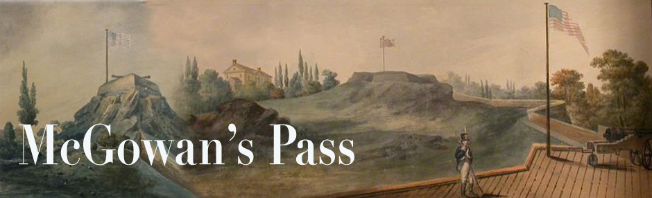
In the early 1860s the New York City Park Commission extended the northern boundary of Central Park from the line of 106th Street to 110th Street. It was a region of steep hills, cliffs, ravines, a marshy creekbed, and the remains of old forts from the Revolution and War of 1812. Little landscaping could be attempted on this wild place, with the happy result that it remains today almost as it was in 1850.
This is when the famous hairpin turns of East Drive were built. Â The published histories of Central Park give no information how they came about. However, these 1850s maps by the Park’s original planner, Andrew Jackson Downing, give some pretty good clues.


Above is the Park region as it looked in its raw state, circa 1851. The switchback road is already there, sort of: a west-southwest road meeting the old Post Road near the lines of 107th Street and 6th Avenue. This is precisely at the point of the 1814 gatehouse seen in so many illustrations. The current route of East Drive became much smoother and more graceful than this makeshift hairpin-turn. But the basic route remained basically the same: a north-northeast road that turns suddenly to the south-southwest.
However, this hairpin was not part of Downing and Vaux’s plan in the 1850s. They wanted to build a simpler northern loop, something akin to the loop at the southern end of the Park. Â If you look at their original plan, below, you will see that their northern extension of East Drive (lower right of map) has no hairpin turns at all. It curves neatly within the northeast corner, then travels parallel to 110th Street before hitting its current route in the northwest Harlem Hills (top right of map).

A very smooth and sensible route; however it means there is no Harlem Meer! Instead of the Harlem Meer, the Downing/Vaux plan proposed making a broad lake out of the ravine in the North Woods. Like the other man-made lakes in the Park, this one seems to have been inspired by the Serpentine in London’s Hyde Park.
But the North Woods Lake was not to be. Instead we got the Harlem Meer. And the East Drive got laid out along the switchback route we now know and love. Below, the “final” product, from an 1875 map.

Pingback: Alexander7